

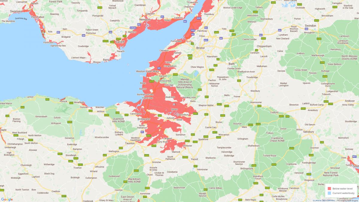
AN interactive map shows that large parts of Somerset could be below the annual flood level from 2030.
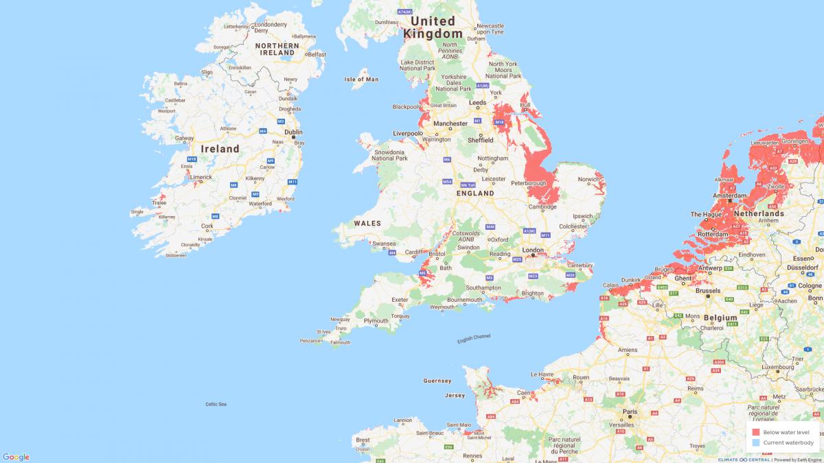
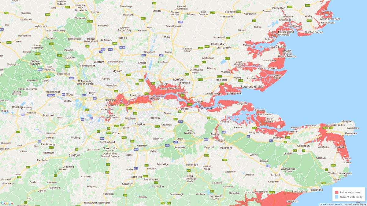
Climate Central’s map uses an elevation data model to assess and highlight the risks posed by rising sea levels.
Founded in 2008, Climate Central is an independent, not-for-profit group of scientists and communicators who research and report on climate change and how it affects people’s lives.
The map is based on peer-reviewed science in leading journals - but its creators say that its maps "incorporate big datasets, which always include some error" and "should be regarded as screening tools to identify places that may require deeper investigation of risk".
The organisation's map shows that vast areas of the county, reaching from Weston-Super-Mare and Portishead on the Bristol Channel to Glastonbury, Bridgwater and Langport, could be below the annual flood level from the start of the next decade.

Dr Benjamin Strauss, Climate Central chief executive, said: “Our greatest hope is that our tools accelerate planning for sea-level rise, and so help to avoid as much suffering as possible.”
The organisation’s website says: “Climate Central uses science, big data, and technology to generate thousands of local storylines and compelling visuals that make climate change personal and show what can be done about it."
Sea levels have increased by around eight inches (23cm) since 1880 due to global warming - and they continue to rise by 3.2mm per year.

At the start of August, a UN report said it is "unequivocal" that human activity is warming the planet.
In 2019, Somerset's local authorities declared or recognised a 'climate emergency' and agreed to collaborate on the Climate Emergency Strategy for Somerset.
The local authorities are aiming to make the county carbon-neutral by 2030.
The UK has set a net-zero emissions target of 2050.


Comments: Our rules
We want our comments to be a lively and valuable part of our community - a place where readers can debate and engage with the most important local issues. The ability to comment on our stories is a privilege, not a right, however, and that privilege may be withdrawn if it is abused or misused.
Please report any comments that break our rules.
Read the rules here